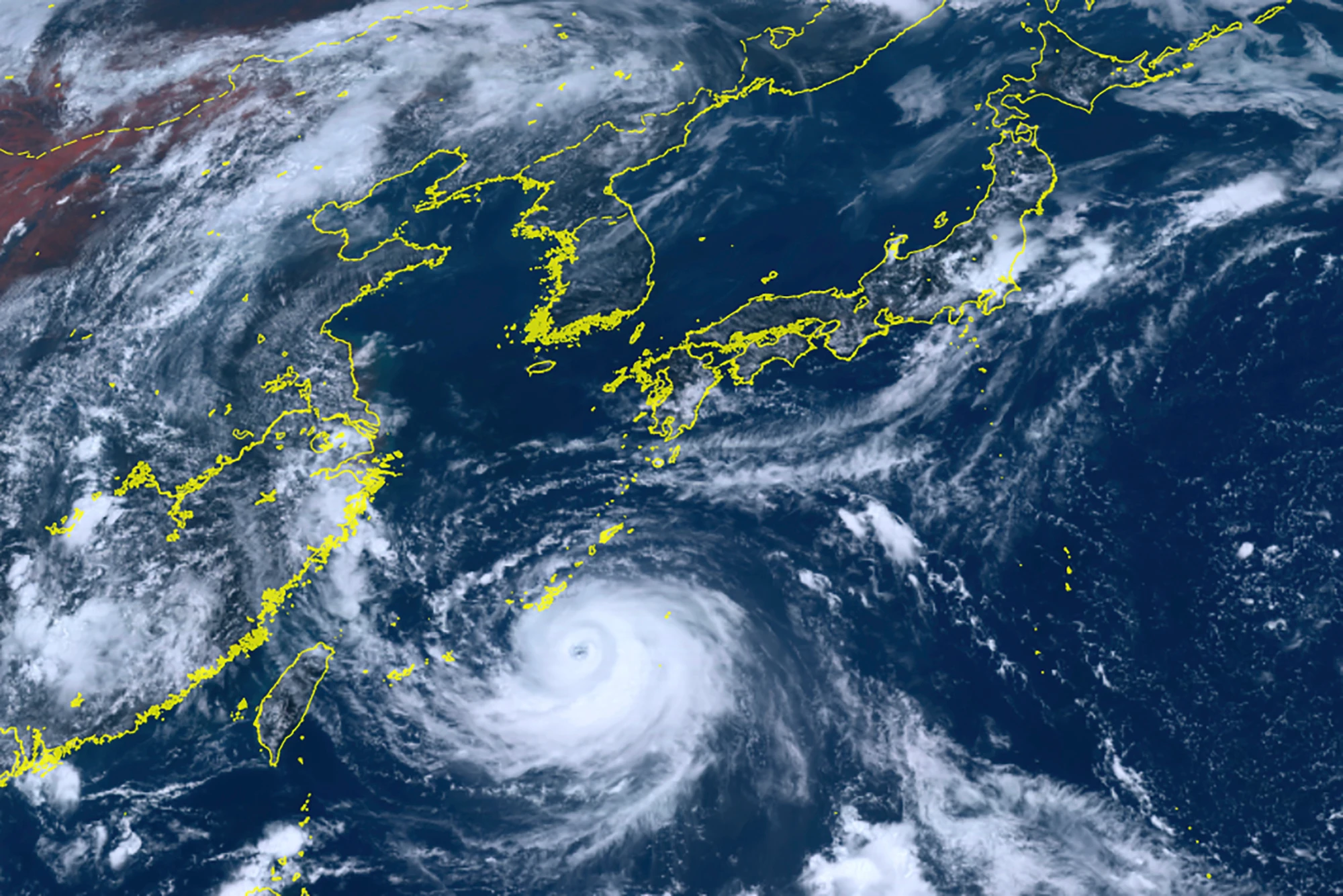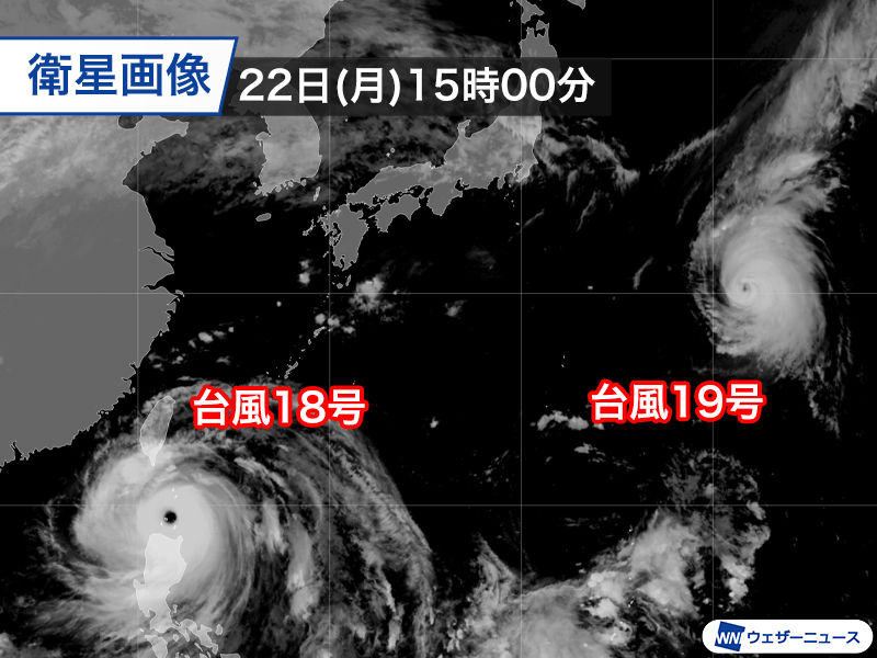
As of 3 PM JST on Monday, September 22nd, Super Typhoon Lagasa (Typhoon No. 18), a large and extremely powerful storm, is moving westward through the Bashi Channel. Strong winds and high waves are expected to continue around the Sakishima Islands even tomorrow as the typhoon moves further away.
Meanwhile, Typhoon Noguri (Typhoon No. 19) has passed its peak intensity and is expected to move slowly northward for some time.
Super Typhoon Lagasa: A Formidable Force
Lagasa, at 3 PM JST on September 22nd, is positioned in the Bashi Channel, maintaining its large size and extremely powerful intensity. Moving west at 20 km/h, it has a central pressure of 905 hPa, with maximum sustained winds of 55 m/s (around the center) and maximum instantaneous winds of 80 m/s.
The typhoon's wind radius has expanded to 500 km, making it a truly massive storm. It is expected to maintain its extremely powerful intensity as it moves into the South China Sea through Tuesday, September 23rd. By Wednesday, September 24th, it is forecast to pass just south of Hong Kong as a very powerful typhoon before making landfall in Southern China or Vietnam.
Continued Strong Winds and High Waves
Due to its large size, strong winds will persist around the Sakishima Islands, especially through Tuesday morning, with average wind speeds of approximately 15 m/s and instantaneous gusts of around 20 m/s. Waves are forecast to remain rough, exceeding 5 meters, with a high wave warning issued. All marine leisure activities should be avoided.
Areas close to the typhoon's path, such as the Philippines' Luzon Island and Taiwan, will experience severe weather through tomorrow. Subsequently, Southern China and Vietnam will see increasing winds and rainfall. Travelers to these regions should monitor the latest typhoon information closely.
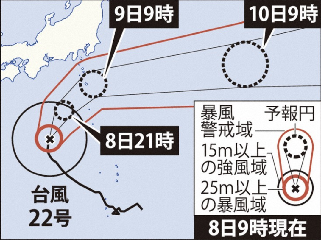
Typhoon Noguri: Slow and Less Threatening
Typhoon Noguri, at 3 PM JST on September 22nd, is located east of Japan. It has passed its peak intensity, downgraded from extremely powerful to very powerful. With a central pressure of 955 hPa, maximum sustained winds of 45 m/s, and instantaneous gusts of 60 m/s, Noguri's movement is currently slow.
It is currently unable to ride the strong westerly winds of the jet stream and is caught between high-pressure systems to its east and west, making its path uncertain. The typhoon is expected to slow down significantly over the weekend, resulting in a large and overlapping forecast cone. Its stagnation over the ocean will limit heat supply, causing it to gradually weaken. The likelihood of Noguri impacting the Japanese archipelago has decreased.
September: Peak Typhoon Season for Landfalls in Japan
Historically, September is the second most active month for typhoon formation (average of 5.0 typhoons), trailing only August. However, September records the highest average number of typhoon landfalls and close approaches to mainland Japan. Therefore, residents in Japan should remain vigilant and ensure all typhoon and heavy rain preparations are in order.
Typhoon names are assigned sequentially from a list of 140 names proposed by member countries of the Typhoon Committee. Lagasa (Typhoon No. 18) is a Tagalog word meaning to speed up, proposed by the Philippines, and is being used for the first time. The previous name, Hagibis, was retired after the devastating Typhoon No. 19 in 2019 (Reiwa 1 East Japan Typhoon). Noguri (Typhoon No. 19) is a Korean name meaning raccoon dog, proposed by South Korea.