New formations detected in the Sunda Strait
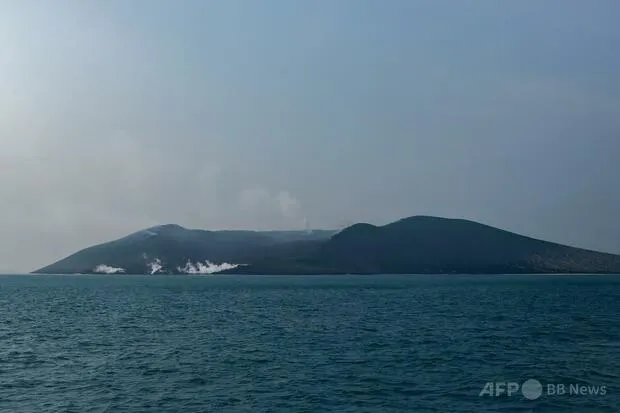
Two small formations resembling islands have been identified in the waters surrounding Indonesia’s Anak Krakatau volcano following a major eruption last month, according to the country’s Center for Volcanology and Geological Hazard Mitigation, known as PVMBG.
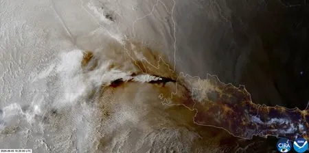
PVMBG director Siti Sumila Rita Sucilawati said on the 2nd that the possible new landforms were detected through an analysis of images captured by Sentinel, the Earth-observation satellite program operated by the European Space Agency. One formation lies approximately 760 meters west-northwest of Anak Krakatau, while the other is located about 495 meters to the southwest.
The discovery has attracted international attention because Anak Krakatau is itself a relatively young volcanic island. It rises from the waters of the Sunda Strait, the channel separating Indonesia’s Java and Sumatra islands, and developed inside the submerged caldera left by the catastrophic eruption of the original Krakatau volcano in 1883.
Scientists urge caution over the “new islands” label
Despite the striking satellite images, officials say it is too early to describe the formations as Anak Krakatau’s “children.” Further fieldwork and geological analysis will be required to determine whether they emerged from underwater volcanic activity or were created by the accumulation of ash and other material expelled during the recent eruption.
That distinction is important. A genuine volcanic island may continue to grow through repeated eruptions, while a mound formed mainly from loose ash, pumice or other deposits could quickly be reshaped or washed away by waves, currents and rainfall.
Anak Krakatau’s own history demonstrates how unstable new land can be. After the volcano began emerging from the sea, several small areas of land appeared from 1927 onward, only to disappear through erosion. It was not until 1930 that a lasting island became established. The two newly observed formations could follow a similar pattern and vanish in the coming weeks or months.
A volcano with regional significance
Anak Krakatau erupted for approximately 25 hours in September, prompting renewed monitoring of the volcano and its surrounding waters. The Sunda Strait is a busy maritime route and a region of significant geological risk, making reliable satellite observation and on-site investigation essential for public safety.
The volcano is also of particular interest to countries across the Pacific and East Asia, including Japan. Japan is one of the world’s most volcanically active nations and has extensive experience using seismic networks, satellite data, coastal monitoring and hazard maps to track volcanic activity. While the Indonesian formations are not directly linked to volcanic events in Japan, developments at Anak Krakatau offer a valuable reminder of how quickly volcanic landscapes can change and why international cooperation in disaster science matters.
For now, PVMBG scientists are continuing to study the formations before reaching a final conclusion. Whether they become permanent islands or disappear beneath the waves, the discovery provides a rare natural case study in the making of volcanic land—and the powerful forces that can erase it just as quickly.