Why the Northern Territories Matter Beyond Sovereignty
Russia’s continued control of the Northern Territories is often discussed as a dispute over land and sovereignty. But security experts argue that the islands also carry major military significance, particularly because of their position around the Sea of Okhotsk and the Pacific approaches to Russia’s Far East.
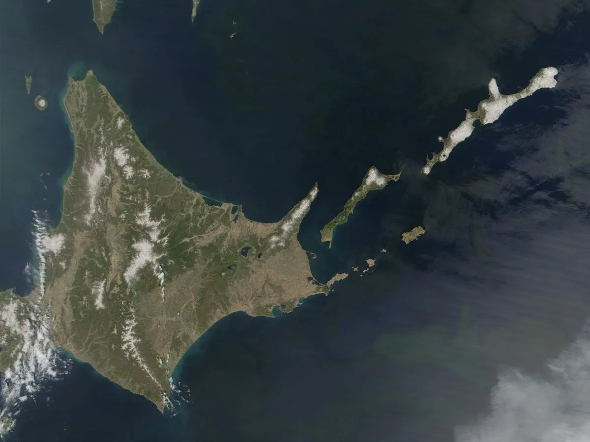
The issue has direct importance for Japan. Japan maintains that the four islands of Etorofu, Kunashiri, Shikotan and the Habomai Islands are inherent parts of its territory. Russia administers the islands, which it calls the Southern Kurils. The disagreement has prevented the two countries from concluding a formal postwar peace treaty.
A Crowded Underwater Security Environment
The waters around Japan are among the world’s most strategically important maritime areas. China operates a large submarine fleet, Russia maintains significant submarine forces in the Pacific and Arctic regions, and North Korea has continued developing submarine and missile capabilities. Japan, meanwhile, operates a highly capable submarine force, while the United States maintains substantial naval power in the wider Indo-Pacific.
Not every submarine operating near Japan is entering Japanese territorial waters. Under international law, territorial seas generally extend 12 nautical miles, or about 22 kilometers, from a country’s coast. Much of the surrounding ocean is international water, where navigation is permitted under established legal principles. However, the proximity of major naval forces makes surveillance and anti-submarine warfare essential to regional security.
Japan’s Maritime Gateways
Straits including the Soya, Tsugaru and Tsushima channels are key maritime gateways. Their legal status and geography allow international vessels to pass through, creating both economic and security challenges. Japan and the United States monitor these approaches using surface ships, maritime patrol aircraft, helicopters, sonar systems and other technologies.
Modern torpedoes have also become significantly more sophisticated. They can use passive sensors to track sound, active sonar to identify reflections and wire-guidance systems that allow a submarine crew to receive information and adjust a weapon’s course. Electric propulsion can reduce acoustic signatures, although no underwater system is completely undetectable. These developments underline why submarine detection and maritime domain awareness remain central to Japan’s defense planning.
The Sea of Okhotsk as a Strategic Bastion
A “reversed map,” viewed from Russia’s perspective, highlights the geography in a different way. Sakhalin and the Kuril chain form a natural arc around the Sea of Okhotsk. Control of key islands and straits helps Russia regulate access to this large body of water, which has long been considered an important operating area for its Pacific Fleet and strategic submarines.
Russia’s ballistic-missile submarines are designed to provide a survivable nuclear deterrent. Submarines are difficult to locate while submerged, allowing them to serve as a second-strike capability in the theory of mutual deterrence. For Moscow, maintaining protected waters in and around the Sea of Okhotsk is therefore viewed as a major national-security interest.
This does not mean that every military scenario described by commentators would automatically occur if the islands changed hands. Access, surveillance, international law, alliance policy and operational realities would all influence the balance. Nevertheless, the geography helps explain why the islands are treated by Russia as a strategic issue rather than simply a territorial possession.
Japan’s Anti-Submarine Strength
Japan has invested heavily in anti-submarine warfare because of its island geography and its alliance with the United States. The Japan Maritime Self-Defense Force operates maritime patrol aircraft, including the P-3C and domestically developed P-1, as well as helicopters and advanced surface vessels. Years of training in the deep and complex waters surrounding the archipelago have helped Japan build strong detection and tracking capabilities.
The U.S. Seventh Fleet, headquartered in Yokosuka, also plays a central role in the wider Indo-Pacific security framework. Japan’s own capabilities remain essential, however, because the Seventh Fleet covers an enormous area stretching across the western Pacific and into the Indian Ocean.
The Northern Territories dispute is therefore connected to a much broader question: who can monitor, protect and operate in the waters surrounding Japan and Russia’s Far East? Understanding the islands’ geography does not resolve the sovereignty dispute, but it clarifies why diplomacy, deterrence and maritime security remain closely linked.