Slow-moving Typhoon meets an active autumn front
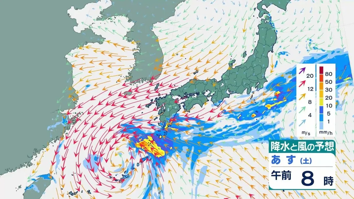
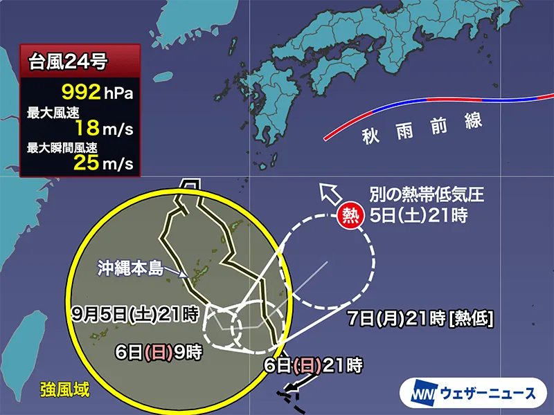
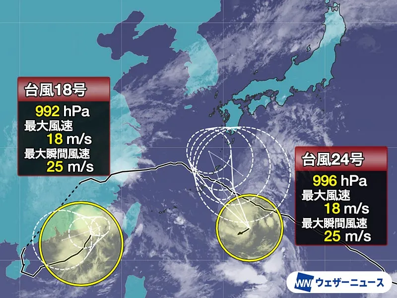
As of 9:00 JST on Wednesday, September 2, Typhoon No. 24 (Krovanh) is slowly tracking north over waters south of Japan, with a central pressure of 996 hPa, sustained winds near the center around 18 m/s (roughly 65 km/h, 40 mph) and gusts to 25 m/s. While Krovanh itself is not expected to undergo rapid intensification, forecasters caution that its tropical moisture is likely to supercharge an autumn rain front descending from the Sea of Japan toward Honshu. The combination raises the risk of widespread, occasionally heavy rain across western and eastern Japan into Friday, September 4.
Track uncertainty and the risk of longer impacts
Through Friday, Krovanh is projected to ride the western edge of the Pacific high-pressure system toward the south of Kyushu. After that, steering winds aloft may weaken as the storm becomes lodged between high-pressure systems on either side, potentially leading to a more erratic or stalling track. This growing uncertainty matters: slower or looping motion could extend the period of rainfall over the same areas, elevating the threat of flooding and landslides even if wind speeds remain modest.
Why the rain threat is elevated
Japan’s seasonal autumn front (shūu zensen) commonly ushers in bands of rain as summer heat retreats. In this case, Krovanh is acting as a moisture pump, feeding humid tropical air into the front. That feed is expected to peak around Friday, when the frontal zone becomes most active. Forecasters anticipate rain to spread broadly from western to eastern Japan, including urban corridors where drainage systems can be quickly overwhelmed by intense downpours.
Western Japan: relief and risk
Parts of western Japan have faced water shortages after relatively light rainfall since July. While this event may bring welcome replenishment to reservoirs and rivers, the same system could also deliver bursts of heavy rain capable of triggering flash floods or debris flows, particularly where soils are dry and less absorbent at first, then rapidly saturated.
What residents and visitors should do now
- Monitor official alerts: The Japan Meteorological Agency (JMA) and local governments issue bilingual advisories, warnings, and evacuation information.
- Prepare for commutes and travel: Heavy rain can disrupt local trains, Shinkansen schedules, and flights. Build in extra time and check operator updates frequently.
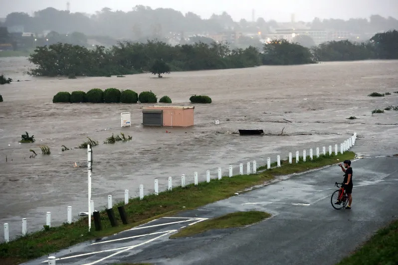
- Avoid flooded areas: Do not enter underpasses or riversides during heavy rain; water levels can rise quickly.
- Check hazard maps: Municipal websites and ward offices provide flood and landslide risk maps. Know your nearest safe shelter.
- Pack essentials: A small go-bag with water, chargers, medication, and copies of ID is practical for residents and visitors alike.
Japan’s robust early-warning systems, disaster-ready infrastructure, and responsive local authorities are designed to keep communities safe. Staying informed and following guidance allows everyday life—and travel plans—to adapt smoothly.
Timeline and areas of concern
Rain is likely to increase from Thursday into Friday across wide swathes of western and eastern Japan, with timing and intensity varying by the typhoon’s exact track. Even after peak rainfall, lingering showers could persist if Krovanh slows. Keep an eye out for updates, as small changes in the storm’s position can shift the heaviest rain bands by prefecture.
Elsewhere in the region: Typhoon Saudel
Typhoon No. 18 (Saudel) was located over the South China Sea at 9:00 JST Wednesday, moving north-northeast at around 20 km/h with a central pressure of 992 hPa, sustained winds near 18 m/s and gusts to 25 m/s. Forecasts suggest it will slow from Thursday and then turn westward, taking a complex path. Active rain bands associated with the storm, combined with the southwest monsoon, are expected to bring periods of heavy rain to coastal China and Taiwan, where authorities have warned of potential flooding and landslides. No direct impact on Japan is anticipated from Saudel.
A historically busy typhoon year
The 2026 season has been unusually active. By the end of August, roughly 10 more typhoons had formed than the long-term average. August alone recorded 10 typhoons—something last seen in August 1966—making it only the third month since records began in 1951 to reach double digits. While the average number of September typhoons is slightly lower than August at 5.0, the historical likelihood of storms approaching Japan remains comparable—and for the main islands (excluding Okinawa and Amami), September actually sees more approaches. Autumn typhoons also tend to move faster, which can concentrate damaging winds and rainfall. Notably, 2026 has seen typhoons form every month from January through September, a pattern recorded only in 1965, 2015, and now 2026.
What’s in a name?
Typhoon names in the western North Pacific and South China Sea are drawn from a list maintained by the Typhoon Committee, comprising contributions from member countries and territories. Typhoon No. 18, “Saudel,” was proposed by Micronesia and refers to a legendary chief’s guard. Typhoon No. 24, “Krovanh” (ក្រវាញ), was proposed by Cambodia and derives from the Khmer word for the cardamom tree. The names cycle in order of formation, not intensity.
Bottom line
Japan is well prepared and well organized for severe weather, with real-time information systems and resilient infrastructure. Still, the combination of Krovanh’s tropical moisture and the invigorated autumn front means heavy rain is a credible threat from western to eastern Japan into Friday. Stay alert to official guidance, plan flexible travel, and take simple precautions—smart steps that keep life in Japan moving safely, even during an exceptionally busy typhoon year.