Heavy Rain Focus Shifts: Southern Kyushu Saturday, Pacific Coast Sunday
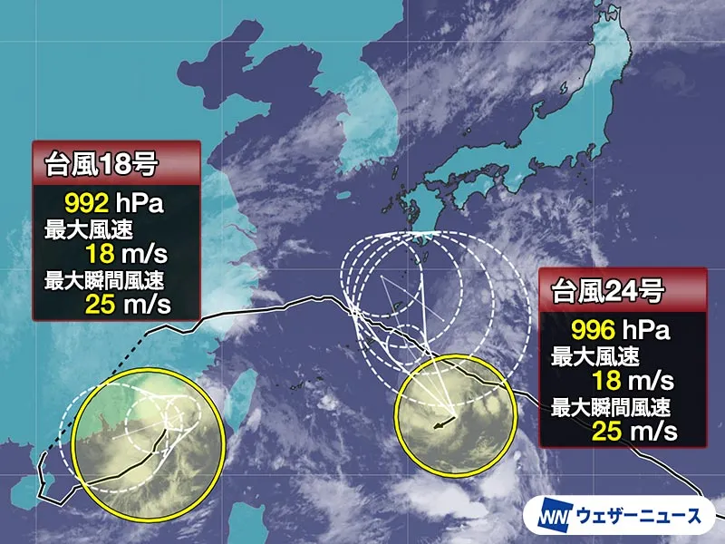
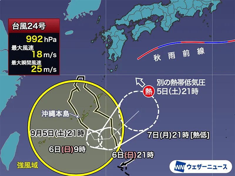
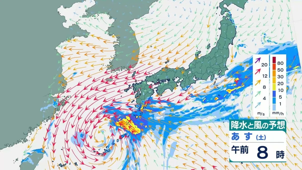
Japan faces an active, fast-changing weekend weather pattern driven by a stationary front south of Honshu and moisture drawn in by Typhoon No. 24 lingering near Okinawa. Forecasters expect the moist tropical air to feed into the front, producing widespread rain along the Pacific side of western Japan. The front is projected to sag south on Saturday morning—allowing showers to ease in many places—then lift north again by evening, re-energizing rain bands from Shikoku through the Kinki region and beyond.
Key Rainfall Risks and Timing
Southern Kyushu remains the most concerning hotspot on Saturday, particularly parts of Miyazaki and Kagoshima, where persistent, vigorous rain clouds are likely to redevelop. The risk of landslides and rapid river rises will remain elevated. As the front edges back north on Saturday night, stronger rain bands may return to Shikoku and the Pacific side of Kinki, with locally intense downpours possible depending on the exact position of the front.
Forecast 24-hour rainfall totals through Saturday evening (highest local amounts):
- Southern Kyushu: up to 250 mm
- Amami region: up to 180 mm
- Kanto-Koshin: up to 100 mm
From Sunday night (6th) into Monday, rain is expected to spread and intensify across a broader area of eastern Japan. Warning-level rainfall is possible in the Tokai and Kanto regions, including around Nagoya and the Tokyo metropolitan area. The precise location and timing of heaviest rain will hinge on small shifts in the front’s position, so residents and travelers should check the latest advisories frequently.
Saturday Temperatures: Warm, Humid, and Unsettled
Despite the wet conditions, heat and humidity will linger for many. Saturday’s forecast highs include: Sapporo 25°C, Kushiro 22°C, Aomori 25°C, Morioka 27°C, Sendai 28°C, Niigata 27°C, Nagano 28°C, Kanazawa 29°C, Nagoya 31°C, Tokyo 26°C, Osaka 30°C, Okayama 30°C, Hiroshima 31°C, Matsue 30°C, Kochi 30°C, Fukuoka 31°C, Kagoshima 30°C, Naha 31°C. Early next week, some locations—including central Tokyo—may rebound to around 30°C again, adding to the muggy feel.
What Travelers and Residents Should Expect
Short, intense bursts of rain could cause localized flooding, water pooling on roads, and reduced visibility. Landslide-prone slopes in southern Kyushu require particular caution on Saturday. Transport disruptions are possible, especially on local rail lines, mountain roads, and regional flights. Shinkansen and major expressways are generally resilient, but temporary speed limits, delays, or brief suspensions can occur during cloudbursts. If you have weekend or Monday-morning travel plans along the Pacific side of western and eastern Japan, build in extra time and monitor operator updates.
Safety and Preparation Tips
- Avoid riverbanks, sea walls, and underpasses during heavy rain; never enter flooded roads.
- Check local hazard maps for landslide and flood zones, particularly in parts of Miyazaki and Kagoshima.
- Prepare rain gear, waterproof bags for electronics, and a small go-bag if you live near steep slopes.
- Monitor official alerts and advisories; confirm evacuation information with local authorities if needed.
- For visitors and expats, bookmark English resources and transit apps; keep your phone charged and portable battery on hand.
Context: Japan’s Late-Summer Pattern and Strong Preparedness
Japan’s late summer into early autumn (roughly August to October) is peak typhoon season. Even when a cyclone stays offshore or stalls far from the main islands, its moisture can be funneled into a stationary front, triggering heavy rain on the Pacific side from Kyushu up through Kanto. This weekend’s setup—front to the south, tropical moisture nearby—is a classic pattern that can flip conditions quickly from calm to torrential within hours.
Japan’s advanced forecasting, dense river monitoring, and early-warning systems are designed for precisely these scenarios. Local governments provide clear guidance, and community preparedness is strong. Travelers will find that, with timely updates and a flexible itinerary, most plans can proceed safely. Still, given the risk of warning-level rain for Tokai and Kanto from Sunday night into Monday, prudence is warranted—particularly for early-week commutes and flights.
Stay Informed
Keep a close eye on updated forecasts through the weekend, especially if you are in southern Kyushu on Saturday or along the Pacific side of western and eastern Japan from Sunday night. Check live advisories and heed any evacuation instructions issued by local authorities. With sensible preparation and Japan’s robust infrastructure, residents and visitors alike can navigate the wet spell confidently.