Typhoon No. 25 Expected to Move Toward Kanto
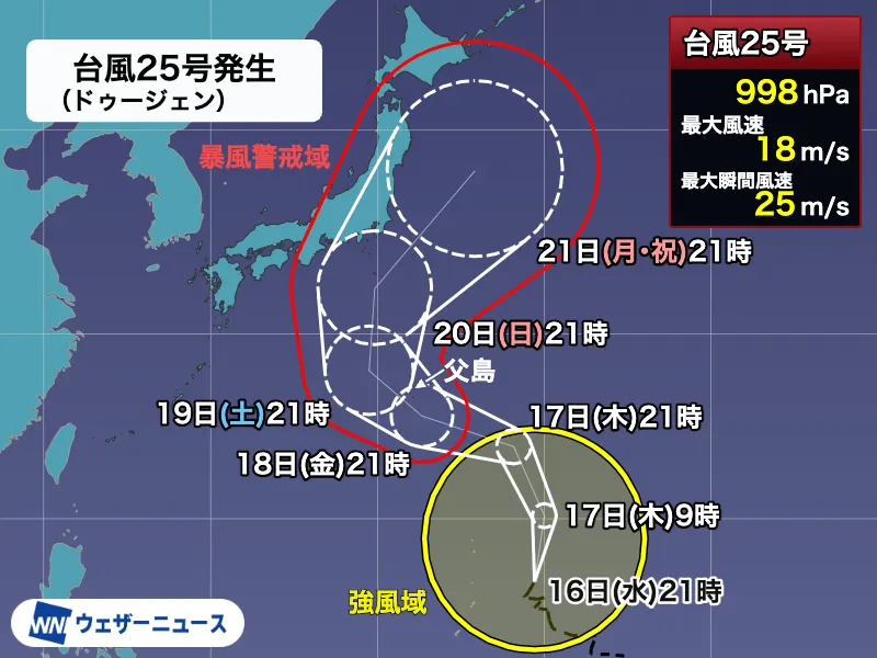
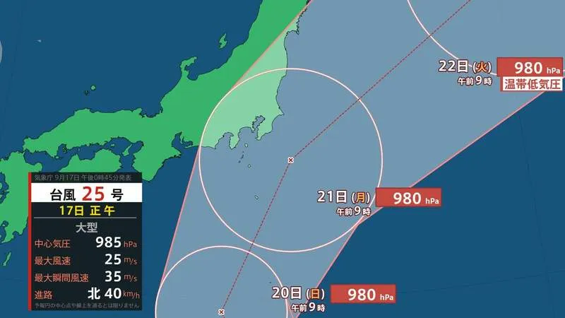
Typhoon No. 25 formed near the Mariana Islands on the night of the 16th and is forecast to move northward toward Japan, according to the Japan Meteorological Agency. The storm is expected to strengthen slightly as it advances and could make its closest approach to the Kanto region, including Tokyo and surrounding prefectures, around Monday the 21st.
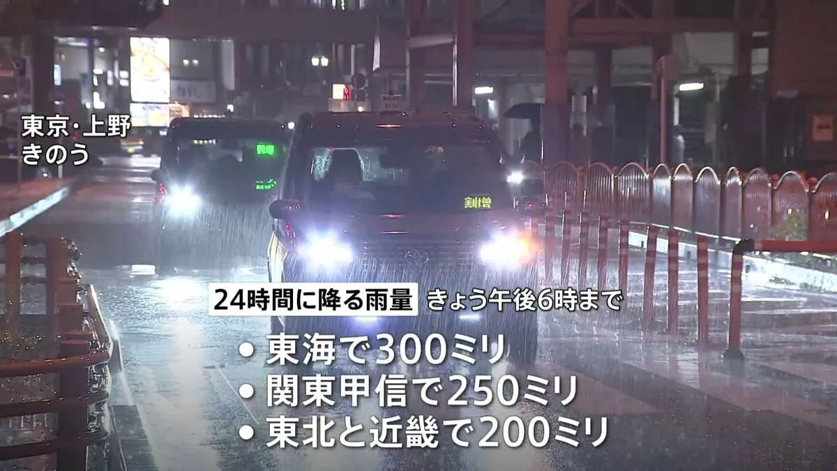
Forecasters are warning that the storm may bring unsettled and potentially hazardous weather during the middle of Silver Week, Japan’s autumn holiday period. Heavy rain, strong winds and rough seas could affect a wide area, while transportation services may experience delays, cancellations or schedule changes depending on the storm’s exact track and intensity.
Forecast for Monday Morning
As of the forecast issued in the source report, Typhoon No. 25 was expected to be located over waters southeast of the Kanto region at approximately 9 a.m. on Monday the 21st. The system was forecast to move north-northeast at around 25 kilometers per hour.
The storm’s central pressure was projected at 980 hectopascals, with maximum sustained winds near its center of 25 meters per second and maximum instantaneous gusts of up to 35 meters per second. These conditions can create dangerous situations, particularly for people near the coast, on exposed bridges, in mountainous areas and around construction sites or unsecured outdoor objects.
Possible Impact on Travel and Daily Life
Kanto is one of Japan’s most densely populated regions and includes Tokyo, Yokohama, Chiba and Saitama. Because the area relies heavily on railways, airports and expressways, even a storm that remains offshore can have a significant impact on daily life and holiday travel.
Visitors and residents should monitor updates from the Japan Meteorological Agency, local governments and transport operators. Railway companies may reduce services or suspend operations if winds become too strong, while airlines could alter flight schedules. Travelers should also allow extra time, check their accommodation’s emergency guidance and avoid coastal areas, riverbanks and mountain trails when conditions deteriorate.
Forecasts May Change
The projected path and strength of a typhoon can change as new observations become available. The timing of the closest approach, the areas receiving the heaviest rainfall and the level of wind risk will depend on the storm’s development and interaction with surrounding weather systems.
Rain and wind simulations for the period from the 18th through the 27th indicate that conditions should be watched closely over several days, rather than only on the expected approach date. Authorities may issue additional warnings, advisories or evacuation information if the risk increases. People in Japan are encouraged to prepare early by checking hazard maps, securing balconies and outdoor items, charging mobile devices and keeping essential supplies available.
For foreign residents and tourists, Japan’s multilingual disaster information services and local government websites can provide practical guidance. In an emergency, follow official instructions promptly and remember that a typhoon’s effects may extend well beyond its center. The latest forecast should be checked before any journey during Silver Week.