Typhoon No. 25 strengthens south of Japan
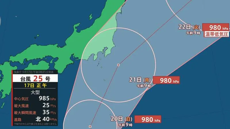
Large Typhoon No. 25 is expected to move north toward Japan during the Silver Week holiday period, bringing the possibility of heavy rain, powerful winds and coastal impacts across the Kanto region. Depending on its final track, the storm could approach the region closely or make landfall in Chiba Prefecture, particularly around the Boso Peninsula.
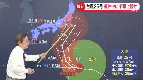
Meteorologist Minoru Kihara said the typhoon has shown signs of strengthening beyond earlier forecasts. Satellite images indicate that the storm’s cloud structure has gradually become more organized as it moves north, with its central circulation developing more clearly. This suggests that the typhoon’s core is becoming stronger, increasing the need for residents and travelers to monitor updated forecasts.
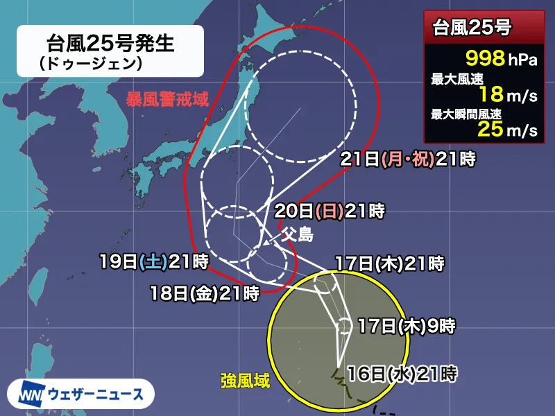
As of 3 p.m. on Friday, September 18, the large typhoon was located south of Chichijima in the Ogasawara Islands. It was forecast to move westward through the Ogasawara island chain through Saturday before turning north. From Sunday through Monday, which is a national holiday in Japan, the system is expected to approach the Kanto region while maintaining a storm area.
Rain may arrive before the typhoon’s strongest winds
One notable feature of Typhoon No. 25 is the concentration of active rain clouds to the north of its center. This means heavy rain could begin in parts of Kanto before the typhoon itself makes its closest approach. The storm’s effects may therefore be felt well in advance of the strongest winds.
Computer rainfall projections indicate that active rain bands could begin reaching Kanto around midnight as Saturday turns into Sunday. The Izu Islands and coastal areas of Chiba are expected to be particularly vulnerable to intense rainfall. Heavy rain could also continue in the Tokyo metropolitan area during Sunday afternoon, raising the risk of flooding, landslides and transport disruptions.
Current forecasts suggest that the heaviest rain in Kanto could occur from around midnight into the early morning and morning hours of Monday. However, typhoon tracks can change significantly, especially several days in advance. Residents should rely on the latest information from the Japan Meteorological Agency and local authorities rather than older forecast maps shared online.
Strong winds and coastal hazards remain a concern
In addition to rainfall, the storm may bring damaging winds to exposed coastal locations and islands. Dangerous waves, storm surges and localized flooding are also possible, particularly in low-lying coastal communities. Ferry services, flights and train operations may be suspended or delayed if conditions deteriorate.
People living in or visiting the affected areas are encouraged to complete preparations by Saturday. Useful steps include securing outdoor objects, checking emergency supplies, charging mobile devices, confirming evacuation routes and avoiding unnecessary travel near rivers, cliffs and the shoreline. Foreign residents and visitors should also check municipal disaster-prevention websites, many of which provide multilingual guidance.
Improving weather expected after the storm
Eastern and northern Japan, including parts of Tohoku, may continue to experience heavy rain through Tuesday as the system moves away. The typhoon is expected to transform into an extratropical low-pressure system over the Pacific east of Japan on Tuesday.
Once the storm passes, sunshine is forecast to return to Tokyo and other areas. The latter part of Silver Week could therefore bring favorable conditions for sightseeing and outdoor activities across much of Japan. Still, recovery may take time in locations affected by flooding, landslides or transportation interruptions. Travelers should confirm service updates before heading out, even after skies begin to clear.