Typhoon No. 27 may approach Ogasawara with powerful winds and high waves
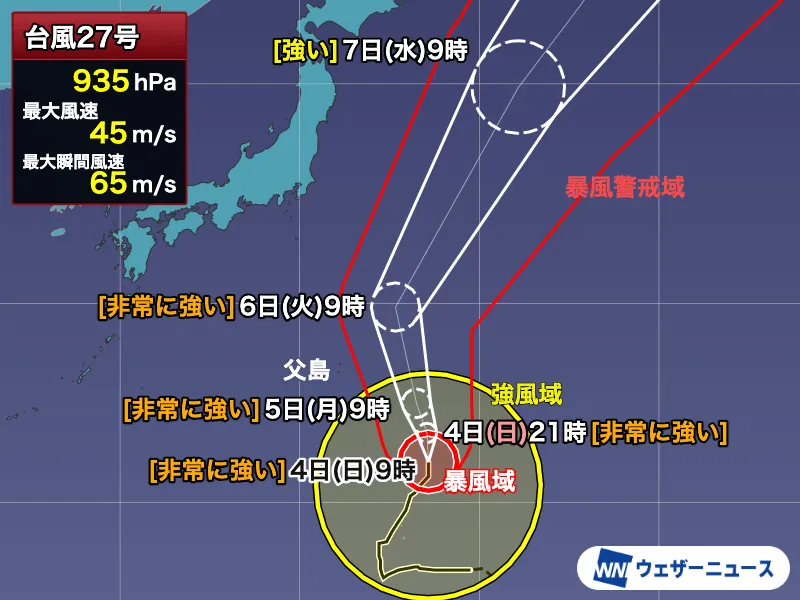
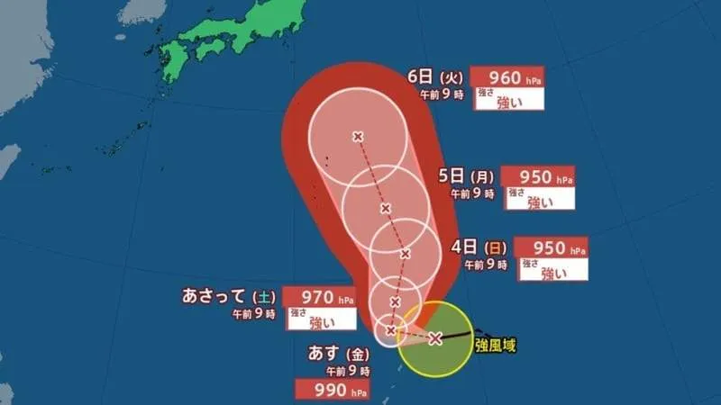
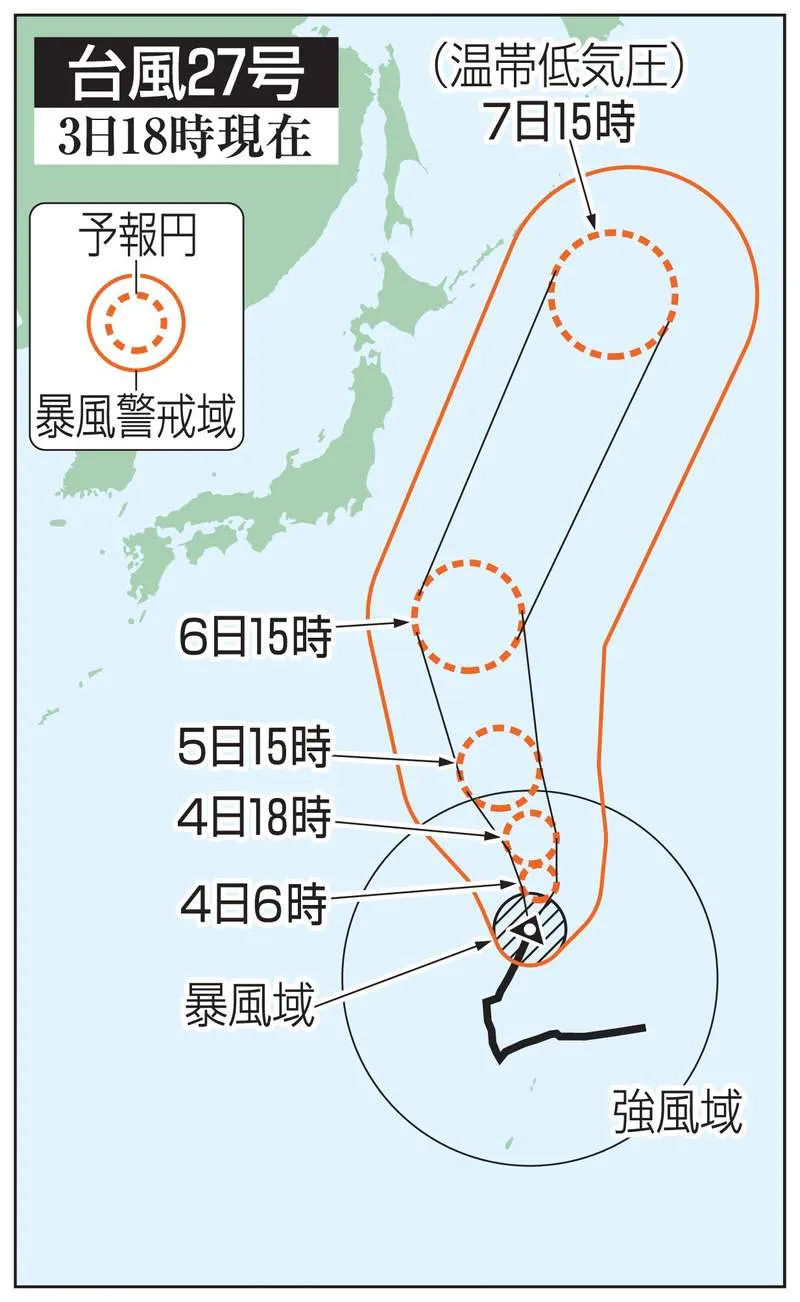
Japan’s Meteorological Agency has warned of dangerous conditions as large and strong Typhoon No. 27 moves northward across the western Pacific and could approach the Ogasawara Islands, part of Tokyo, around October 5 to 6. The storm is forecast to strengthen as it advances and may reach the island chain with very strong intensity.
The agency urged residents, visitors and vessel operators to remain alert for high waves accompanied by long-period swells, as well as powerful winds. Such swells can arrive from distant storm activity and may make coastal conditions hazardous even before the center of a typhoon comes close. People are advised to stay away from shorelines, breakwaters and other exposed coastal areas when conditions deteriorate.
Waves forecast to reach 8 meters
According to the Meteorological Agency, waves around the Ogasawara Islands are expected to reach approximately 6 meters on October 4 and 8 meters on October 5, with swells accompanying both forecasts. The predicted maximum wind speed for October 5 is 23 meters per second, with maximum instantaneous gusts potentially reaching 35 meters per second.
These conditions could affect maritime travel, fishing activities, port operations and access between islands. The Ogasawara Islands are located roughly 1,000 kilometers south of Tokyo’s main island and are accessible primarily by sea, making weather-related disruptions particularly significant for residents, travelers and supply services. Visitors in the area should monitor official updates and follow instructions from local authorities and transport operators.
Storm details and projected path
At 3 p.m. on October 3, Typhoon No. 27 was located near the Mariana Islands in the Pacific. It was moving north-northeast at approximately 20 kilometers per hour. The storm had a central pressure of 960 hectopascals, maximum sustained winds of 40 meters per second near its center and maximum instantaneous winds of 55 meters per second.
A storm area within a radius of 130 kilometers from the center was experiencing winds of at least 25 meters per second. The system is expected to continue moving northward before tracking east of Japan. While the current forecast places the greatest concern on the Ogasawara Islands, the exact path and intensity may change, and authorities will continue to update warnings as new observations become available.
Residents and travelers urged to prepare early
Typhoons are a regular part of Japan’s late-summer and autumn weather patterns, but each storm can bring different risks depending on its size, speed and track. Strong winds can damage structures, disrupt communications and make travel dangerous, while high waves and storm surges can threaten coastal areas. Even when a storm does not make landfall, its outer bands may create hazardous conditions over a wide area.
The Meteorological Agency recommends checking forecasts through official channels, securing loose objects, preparing essential supplies and avoiding unnecessary travel during the most dangerous period. Anyone in the Ogasawara Islands should prioritize local evacuation and safety guidance. The storm is expected to move northward over the Pacific east of Japan after its approach, but authorities will continue monitoring whether its broader circulation affects other coastal areas.