Typhoon Choi-wan tracks north toward the Ogasawara Islands
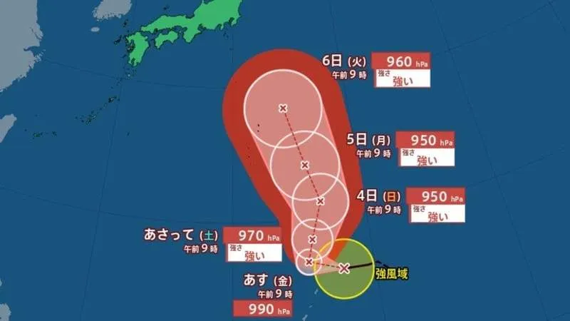
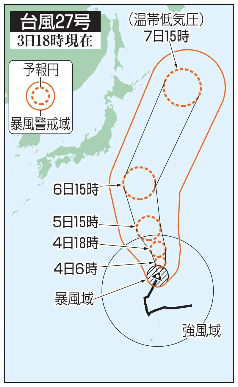
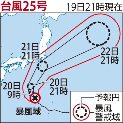
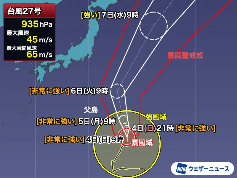
Typhoon No. 27, known as Choi-wan, was moving north-northeast through waters near Japan’s Ogasawara Islands as of 9 a.m. on Sunday, October 4. The large and very strong storm is expected to intensify further before passing east of the island chain from Monday, October 5, into Tuesday, October 6.
According to the latest forecast, the typhoon had a central pressure of 935 hectopascals and was moving at approximately 25 kilometers per hour. Maximum sustained winds near the center were estimated at 45 meters per second, with instantaneous gusts reaching 65 meters per second. The storm is expected to strengthen slightly, with its central pressure potentially falling to around 925 hectopascals and its maximum sustained winds rising to approximately 50 meters per second overnight.
Strong winds and dangerous waves expected
Conditions around the Ogasawara Islands are expected to deteriorate gradually from Sunday afternoon. Average wind speeds could reach around 15 meters per second by Monday morning. As the typhoon comes closest from Monday night through Tuesday morning, average winds may rise to approximately 20 meters per second, while maximum gusts could approach 30 meters per second.
Such conditions can send unsecured objects flying and may cause fallen trees, structural damage and power outages. Marine conditions are expected to become especially dangerous, with waves exceeding six meters at the storm’s closest approach. Swells will add to the danger, creating hazardous conditions for fishing boats, ferries and other vessels.
Residents should secure or move indoors any objects that could be blown away and arrange early evacuation or mooring measures for boats. Authorities and weather officials are advising people to complete preparations during calm conditions and remain indoors in a safe location once the weather worsens. Travelers should also check ferry and flight information before departing for or from the Ogasawara Islands.
Limited rainfall impact, but coastal areas should remain alert
Because the typhoon’s center is forecast to pass over the ocean east of the islands, rainfall impacts are expected to be less significant than the wind and wave impacts. However, this does not eliminate the risk of localized heavy rain or sudden changes in conditions.
After passing near the Ogasawara Islands, Choi-wan is increasingly likely to turn northeast and move away over the Pacific east of Japan’s main islands. Major direct impacts on Honshu are not currently expected, but elevated waves and swells may affect a broad stretch of the Pacific coast. Northern and eastern coastal areas, including parts of the Kanto region and areas farther north, should also be prepared for stronger northerly winds.
An unusually active typhoon season
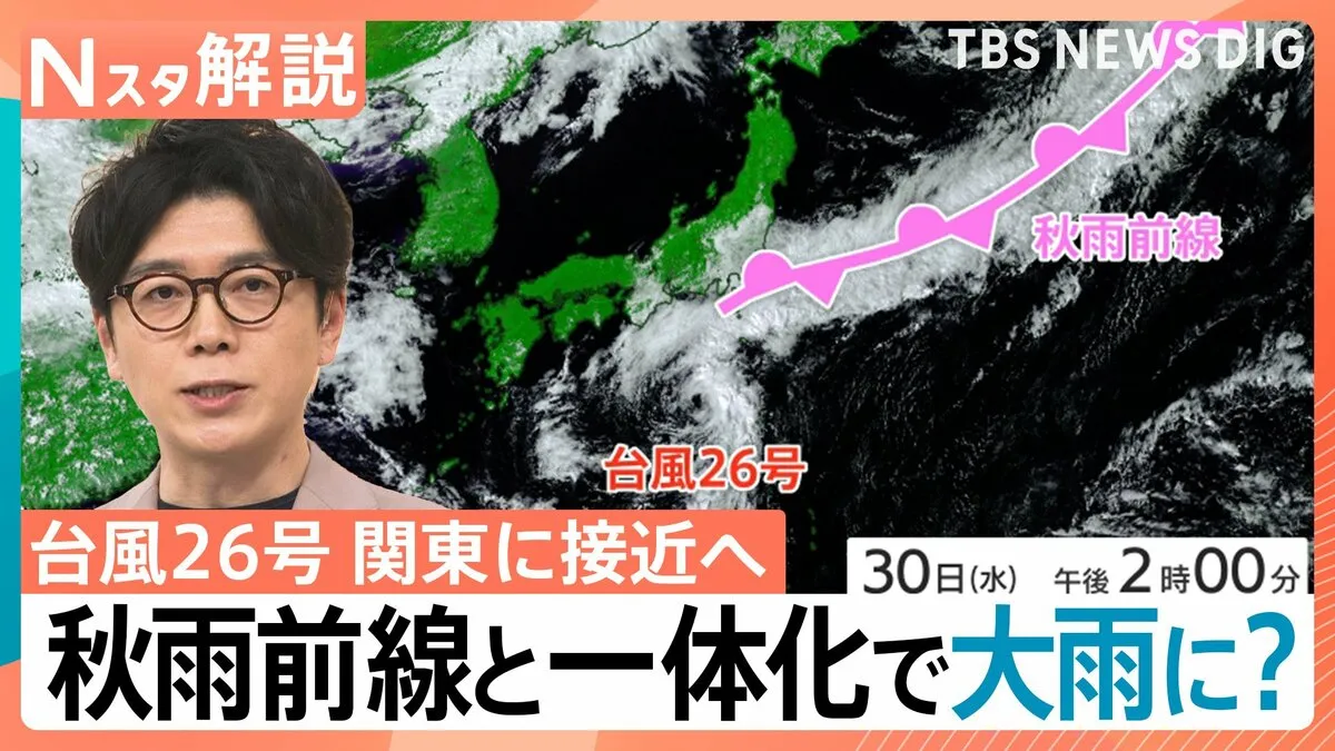
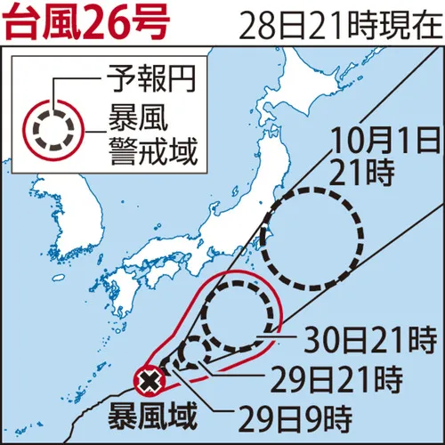
Choi-wan is the first typhoon to form in October and developed roughly one week after Typhoon No. 26, Surigae. It is also the 27th typhoon to form at this point in the year, ranking among the earliest such occurrences in Japan’s historical records.
Japan has experienced an unusually active 2026 typhoon season, with approximately seven more storms than average recorded by the end of September. October typically sees an average of 3.4 typhoons, meaning the season remains active. Autumn typhoons can move quickly and may bring significant hazards even when their centers remain offshore.
This year is also only the third year since records began in 1951 in which typhoons have formed every month from January through October. The previous years were 1965 and 2015. Residents across Japan should therefore maintain basic typhoon and heavy-rain preparations, including emergency supplies, charged communication devices and knowledge of nearby shelters.
Meaning behind the name Choi-wan
Typhoon names in the western North Pacific and the South China Sea are selected from a list of 140 names proposed by countries and regions belonging to the international Typhoon Committee. Choi-wan was proposed by Hong Kong and derives from a Chinese term referring to a colorful cloud, or “彩雲.” The name is also associated with Choi Wan Estate, a well-known residential development in Hong Kong.