Typhoon No. 26 moves eastward from the Daito Islands
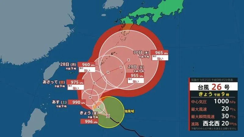
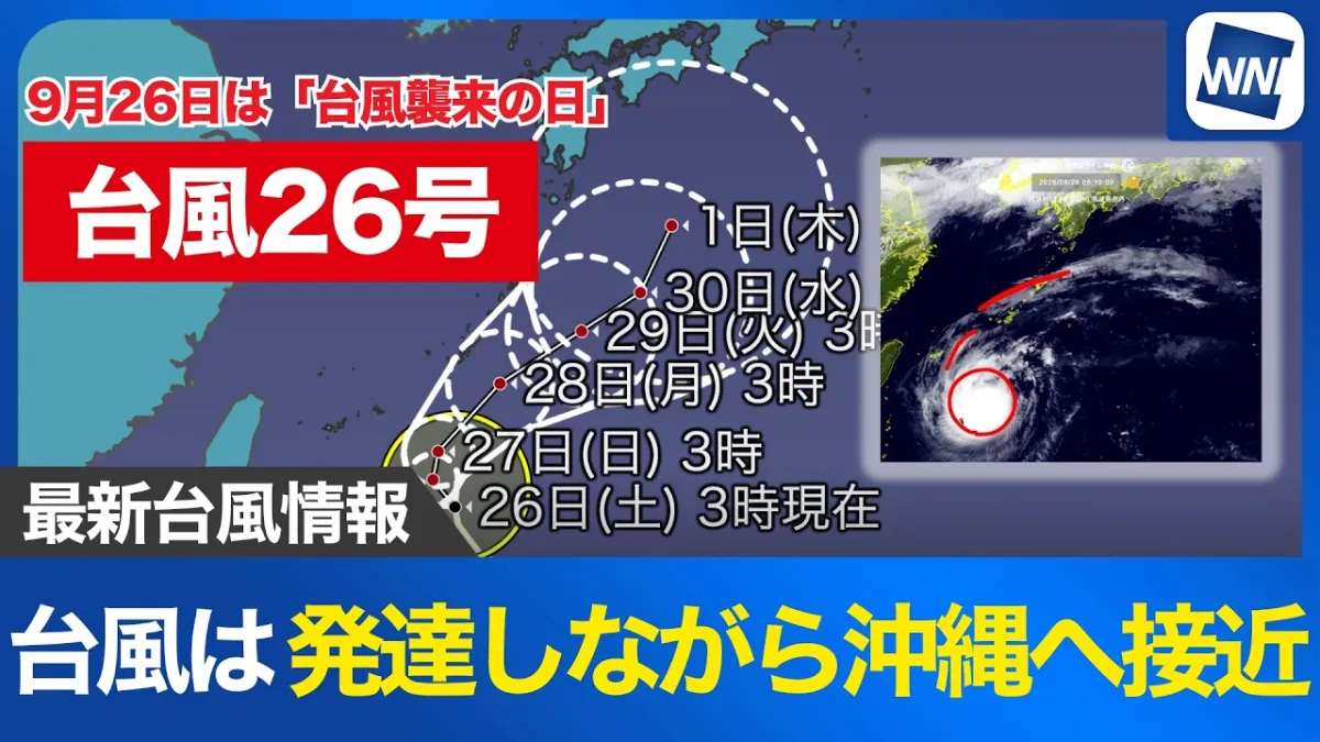
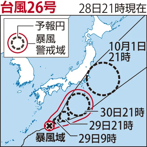
Typhoon No. 26 was moving east-northeastward near Japan’s Daito Islands on the 28th, with forecasters expecting the storm to reach waters near the Izu Islands around October 1. Depending on its future path, the system could approach the Tokai and Kanto regions, including areas near major population centers such as Nagoya and Tokyo.
According to the Japan Meteorological Agency, the typhoon was located approximately 230 kilometers northeast of Minami-Daito Island as of 9 p.m. on the 28th. It was traveling east-northeast at around 15 kilometers per hour. The storm had a central atmospheric pressure of 965 hectopascals and maximum winds of approximately 40 meters per second near its center.
Forecast path remains subject to change
The typhoon is expected to gradually lose strength as it moves eastward. However, a weakening storm can still bring hazardous conditions, including strong winds, heavy rain, high waves and rough seas. The precise impact on Japan will depend on the storm’s track, speed and interaction with surrounding weather systems.
The Izu Islands, a chain of volcanic islands south of Tokyo, are particularly exposed to Pacific storms. The islands are popular for nature tourism, diving, hot springs and island travel, but transportation services can be disrupted quickly when weather conditions deteriorate. Ferry routes and flights may be suspended, while local authorities could issue evacuation or safety guidance if necessary.
Possible effects on central and eastern Japan
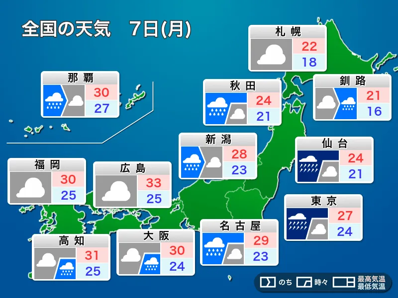
If Typhoon No. 26 shifts closer to the Japanese mainland, the Tokai region could experience strong winds and heavy rainfall. The area includes Shizuoka, Aichi, Gifu and Mie prefectures and is home to important industrial centers, transport links and coastal communities. Farther east, the Kanto region, which includes Tokyo, Kanagawa, Chiba, Saitama and surrounding prefectures, could also see rainfall and transportation disruptions depending on the final route.
For foreign residents and visitors, Japan’s weather warnings are provided through the Japan Meteorological Agency, local government websites and emergency notification systems. Travelers should check updates before taking domestic flights, ferries or long-distance trains, particularly when visiting coastal areas or islands. It is also advisable to confirm cancellation policies and follow instructions from local authorities rather than relying only on social media reports.
Residents urged to prepare early
People in potentially affected areas should secure outdoor items, review evacuation routes and keep mobile devices charged. Basic supplies such as drinking water, food, medicines, flashlights and portable batteries can be useful during severe weather. Even if the typhoon does not make landfall, its outer rainbands may produce localized downpours and dangerous winds.
Japan has extensive experience preparing for typhoons, with detailed monitoring and emergency systems designed to provide timely information. Still, forecasts can change as a storm approaches. Residents and travelers should continue checking official updates from the Japan Meteorological Agency and local municipalities through October 1, when Typhoon No. 26 is expected to pass near the Izu Islands.