Typhoon No. 25 Strengthens on Approach to Japan
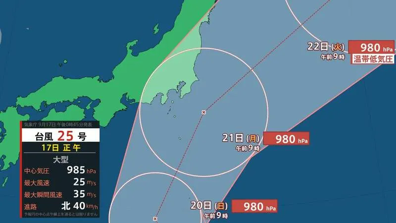
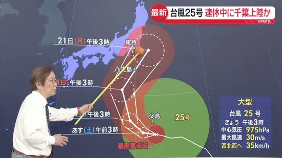
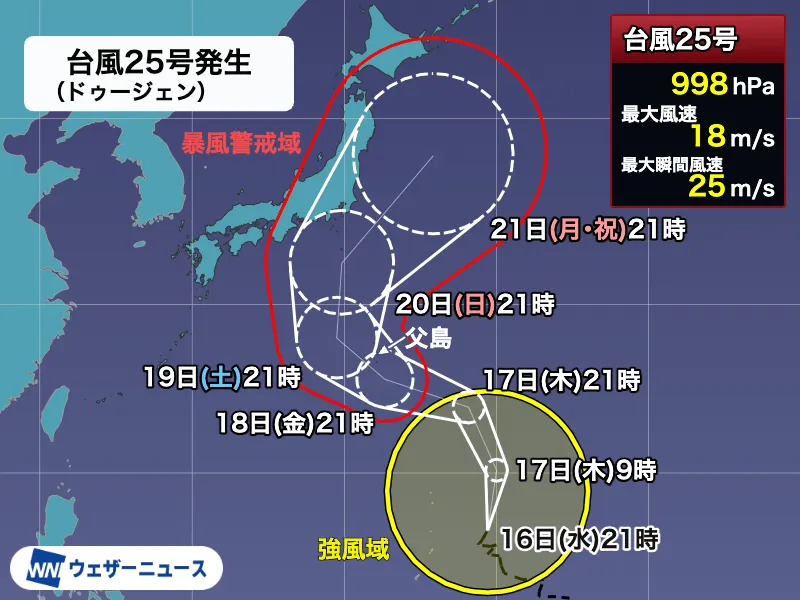
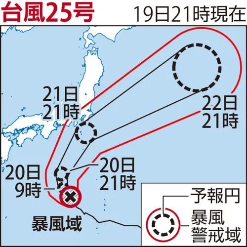
Large Typhoon No. 25 moved away from the Ogasawara Islands on the 19th and continued northward toward Japan while gaining strength, according to the Japan Meteorological Agency. The storm is expected to approach the Kanto and Tokai regions as early as the afternoon of the 21st, bringing the possibility of powerful winds and warning-level rainfall.
As of 9 p.m. on the 19th, the typhoon was moving north-northwest over waters south of Japan at approximately 20 kilometers per hour. Its central pressure was 970 hectopascals, while maximum sustained winds near the center reached 35 meters per second. The system was maintaining a storm-force wind area as it moved closer to the Japanese mainland.
Strong Winds and Heavy Rain Expected
The most serious wind threat is expected around the Izu Islands and offshore areas near Kanto on the 21st. Maximum instantaneous wind speeds of up to 50 meters per second are forecast in those areas, while winds on land could reach 35 meters per second. Winds of this strength can make travel hazardous, damage structures, disrupt power supplies, and send loose objects flying.
Residents in exposed coastal and island communities should remain alert even before the typhoon’s center approaches. Strong winds and high waves may affect shipping, ferry services, ports, and air travel. Travelers planning to use airports, railways, highways, or local buses in eastern and central Japan should check updated operating information directly with transport providers.
Heavy rain is also expected to begin before the typhoon reaches the mainland. For the 24-hour period through 6 p.m. on the 20th, rainfall could reach 150 millimeters in parts of Kanto and the Izu Islands, and 120 millimeters in the Tokai region. In the following 24-hour period through 6 p.m. on the 21st, totals could reach 300 millimeters in Kanto, the Izu Islands, and Tokai, as well as 120 millimeters in Tohoku.
Risks Include Flooding and Landslides
Such rainfall can quickly raise river levels and trigger flooding in low-lying areas. Saturated mountain slopes may also become unstable, increasing the risk of landslides, particularly in areas that have already experienced recent rain. Japan’s mountainous terrain and densely populated urban areas mean that even locations far from the typhoon’s center can experience dangerous conditions.
People living in or visiting affected areas should monitor announcements from the Japan Meteorological Agency, municipal governments, and local emergency services. In Japan, evacuation information is issued by local authorities and may differ from one municipality to another. Foreign residents and visitors can use official multilingual disaster-information services, confirm the location of nearby evacuation shelters, and keep mobile phones charged.
Residents and Visitors Urged to Prepare Early
Authorities commonly advise people to secure balconies and outdoor items, avoid unnecessary travel during the worst conditions, and prepare drinking water, food, medicines, flashlights, batteries, and portable chargers. Anyone near a river, steep slope, coastline, or other hazardous area should review evacuation routes before conditions deteriorate.
The forecast may change as the typhoon develops, and the exact track, rainfall distribution, and timing remain subject to updates. Japan’s disaster-prevention system provides frequent weather bulletins and clear local alerts, making it important to check reliable official sources rather than rely on social media rumors. Early preparation can help residents and visitors navigate disruptions safely while communities across Japan respond to the approaching storm.