Typhoon No. 25 to Approach Southern Kanto
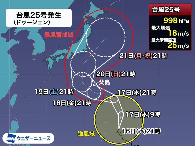
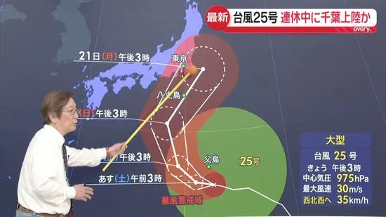
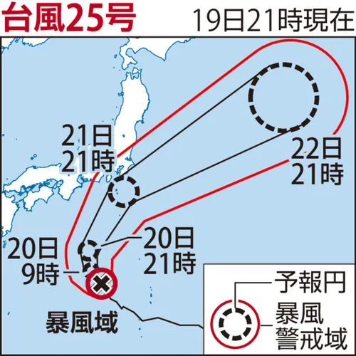
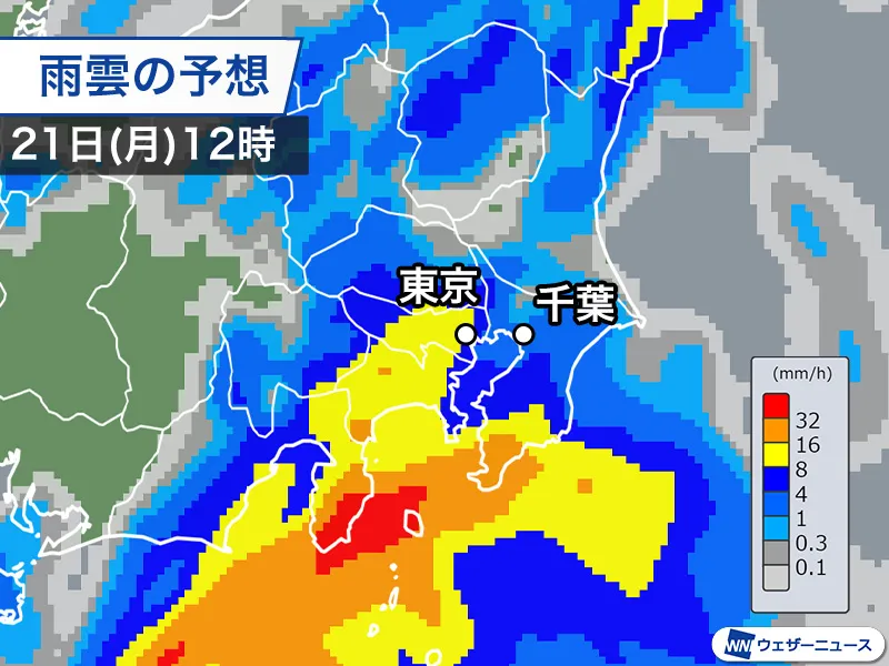
Large and powerful Typhoon No. 25 is expected to make its closest approach to southern Kanto on Monday, September 21, the Respect for the Aged Day national holiday. Heavy rain has already begun in parts of the Izu Islands and the Kanto region, prompting strong warnings about flooding, landslides and other rain-related disasters.
The storm is forecast to move northeast near the Izu Islands during Monday before reaching waters south of the Boso Peninsula by nighttime. As the typhoon approaches, rainfall and winds are expected to strengthen across coastal areas of Kanto and Shizuoka Prefecture, with the worst conditions likely Monday night.
Rain Intensifies Before the Typhoon Arrives
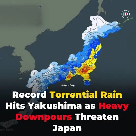
Rain clouds associated with an atmospheric boundary north of the typhoon have already moved into the Kanto region. Southern parts of the region have experienced particularly heavy rainfall. In Katsura, Chiba Prefecture, 34.5 millimeters of rain fell in one hour by 9:33 a.m., according to the report.
Meteorologists are also watching for the development of an “coastal front” near the Boso Peninsula. This type of concentrated rain band can form when colder air over inland areas meets warm, moisture-rich air brought by a typhoon. If it develops, intense rainfall could continue for several hours in the same location, increasing the risk of flash flooding and landslides.
Rail and Travel Disruptions Reported
Heavy rain has already affected transportation in Chiba. JR East has suspended operations on the Sotobo Line because sections of track have been flooded. Further disruptions to railways, roads and other transport services are possible as the storm moves closer.
Residents, commuters and visitors in Japan should check official railway websites and local government announcements before traveling. Foreign visitors should also be aware that services may be suspended or reduced with limited notice during severe weather. Japan’s rail network is highly reliable in normal conditions, but operators prioritize passenger safety when tracks, bridges or surrounding areas are threatened by flooding or strong winds.
Major Rainfall and Disaster Risks
By Tuesday morning, total rainfall is expected to reach locally around 300 millimeters in the Izu Islands and more than 200 millimeters in southern Kanto. These amounts could be significantly higher if a rain band resembling a linear precipitation zone forms. Such systems can produce prolonged, extremely heavy rain over a narrow area.
Authorities are urging people, particularly in coastal and low-lying areas of Chiba, to remain highly alert for sudden road flooding, river overflow and mudslides. Chiba experienced serious rain-related disasters in August, making renewed rainfall a significant concern. People should avoid unnecessary travel during the storm, stay indoors where possible and move to safer locations early if evacuation information is issued.
Conditions Expected to Improve Tuesday
Typhoon No. 25 is forecast to move east of Japan on Tuesday, September 22, gradually pulling away from the mainland. Strong winds and high waves may continue even after the center of the storm has moved offshore, but weather conditions are expected to begin improving.
By Wednesday, September 23, the final day of the five-day holiday period and Autumnal Equinox Day, a moving area of high pressure is expected to bring sunshine to much of the region. However, travelers should confirm the latest forecasts and transport information before making plans, as local impacts may remain after the rain ends.