Typhoon and autumn rain front create widespread hazards
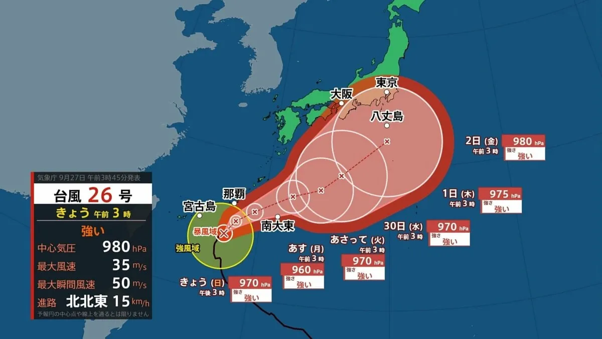
Japan is preparing for a complex weather situation on Sunday the 27th, as a powerful Typhoon No. 26 approaches Okinawa while an autumn rain front continues to bring periods of heavy rain from Kyushu through the Tokai region. Forecasters are warning that the combined weather pattern could produce dangerous flooding, landslides, high waves and strong winds in several areas.
Line of storms may develop over Kyushu
Rain is already intensifying across Kyushu, where a linear rain band could form by around 9 a.m. A linear rain band is a narrow, persistent line of thunderstorms that can bring extremely heavy rain to the same location for several hours. When this occurs, the risk of flooding and landslides can rise rapidly.
Fukuoka, Saga, Nagasaki and Kumamoto prefectures are considered particularly vulnerable during the morning hours. Residents in areas prone to flooding or landslides should secure their safety early, follow instructions from local authorities and avoid traveling through flooded roads or near rivers and steep slopes. In Japan, evacuation information is issued by municipal governments, and residents should check official local alerts rather than relying solely on social media reports.
Rain is expected to continue intermittently from Kyushu through Tokai from daytime into the evening. Even locations away from the typhoon itself may experience significant rainfall because the autumn front can draw in warm, moisture-laden air from around the storm.
Weather improves in Kanto, while temperatures rise
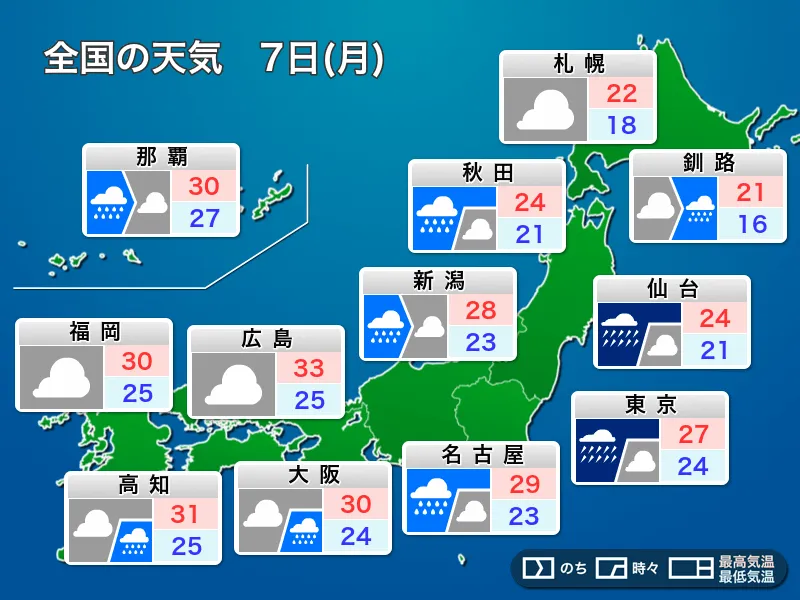
In the Kanto region, including Tokyo, the rain front is expected to move away, allowing conditions to gradually improve. Sunshine may appear through breaks in the clouds, particularly during the afternoon, and temperatures will be higher than on Saturday. The air may feel slightly humid when people are active outdoors.
Hokuriku and Tohoku are expected to see mainly sunny conditions, with warm and relatively dry weather. Forecast high temperatures include 24 degrees Celsius in Tokyo, 28 degrees in Niigata and Fukuoka, 31 degrees in Naha and 32 degrees in Kagoshima. Sapporo is forecast to reach 23 degrees, while Osaka and Hiroshima are expected to reach about 25 degrees.
Okinawa urged to complete preparations early
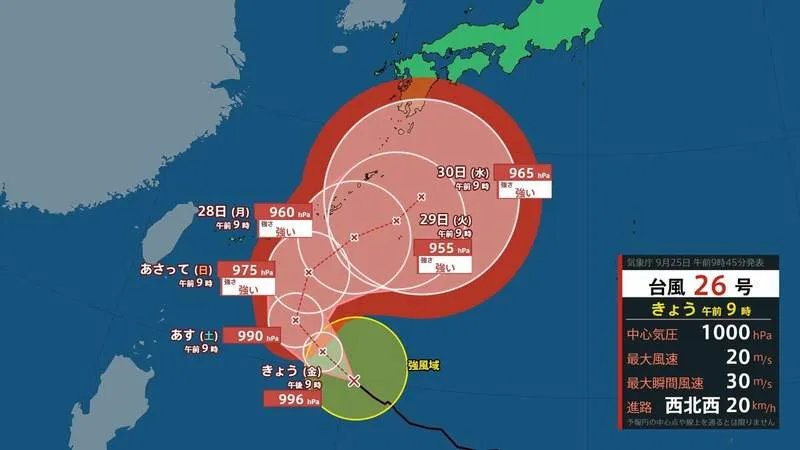
Typhoon No. 26 has strengthened and is approaching Okinawa slowly. Although the most active rain clouds are expected to remain mainly over the sea, sudden bursts of heavy rain and thunderstorms remain possible. Winds around Okinawa’s main island are expected to strengthen from around midday on Sunday and become increasingly powerful through the night.
Residents are advised to complete preparations during the morning, before conditions deteriorate. This includes bringing outdoor items indoors, securing windows and balconies, charging mobile devices, preparing emergency supplies and confirming evacuation routes. People should avoid going outside once violent winds begin.
Uncertain track after Tuesday
The typhoon is expected to approach Okinawa through around Tuesday the 29th while maintaining strong intensity. Long-lasting high waves and storm-force winds will remain a concern. Wave heights, including swells, could reach six meters around Okinawa on Sunday, seven meters on Monday and six meters on Tuesday. Around the Amami Islands, waves could reach four to five meters.
Maximum instantaneous winds of up to 35 meters per second are forecast around Okinawa between Sunday and Tuesday. Up to 80 millimeters of rain may fall in the heaviest-affected areas over a 24-hour period.
From Wednesday onward, the typhoon’s forecast track becomes highly uncertain. If it follows the northern side of the forecast area, it could approach western or eastern Japan later in the week. Even if it takes a more southerly path, the autumn rain front may remain near Honshu and combine with humid air from the typhoon, creating another period of potentially intense rain. Residents, travelers and foreign visitors in Japan should continue checking the Japan Meteorological Agency, local government notices and transport operators for the latest information.