Emergency rain alert for Kagoshima’s island region
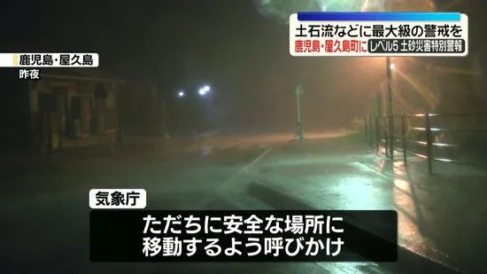
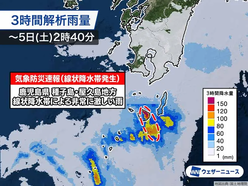
The Japan Meteorological Agency (JMA) has issued an urgent “Meteorological Quick Report: Linear Precipitation Band Occurrence” for the Tanegashima–Yakushima area of Kagoshima Prefecture at 2:48 a.m. JST, warning that extremely heavy rain is repeatedly striking the same locations. Authorities say the risk of landslides, inundation in low-lying areas, and river surges or flooding is sharply increasing. Residents and travelers are urged to act without delay, follow local evacuation instructions, and avoid dangerous terrain near slopes, cliffs, streams, and swollen riverbanks.
What is happening now
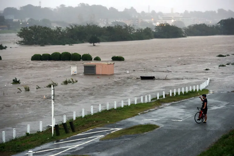
Very intense rainfall is persisting across parts of Tanegashima and Yakushima. Preliminary observations suggest totals exceeding 200 mm in just three hours in some zones—more than enough to trigger rapid-onset hazards. Conditions may deteriorate quickly: flash floods can develop with little warning, and saturated slopes can fail suddenly. JMA and municipal governments advise immediate evacuation if you are instructed to move, or if you personally sense danger even before formal orders arrive. If traveling to a designated shelter is unsafe, move to a sturdy building away from slopes and streams, select a higher floor less prone to inundation, and secure your safety first.
Understanding Japan’s “linear rainband” alert
A linear precipitation band (known in Japan as a senjō-kōsuitai) forms when storm cells align and continuously dump torrential rain over the same area. To communicate urgency clearly, JMA began using the “linear rainband” terminology in 2021 and, from May 2026, has provided this notice under the Meteorological Quick Report framework. While such alerts may be issued around 10–20 times per year nationwide, they still signify an event that is rare and severe for the specific area affected—comparable to a once-in-several-years deluge. In short: this is not business as usual, and complacency can be deadly.
Local context: Tanegashima and Yakushima
These islands sit south of Kyushu in Kagoshima Prefecture—one of Japan’s most captivating regions. Yakushima, a UNESCO World Heritage site, is famed for ancient cedar forests and steep, rain-fed mountains. Tanegashima, home to Japan’s spaceport, features coastal plains and river systems that can swell rapidly in downpours. The topography that makes these islands beautiful also heightens landslide and flash-flood risks during the rainy season. Visitors should understand that Japan’s advanced warning culture, meticulous hazard mapping, and well-run shelters help reduce risk—provided people heed guidance early.
Safety guidance for residents and travelers
• Follow municipal evacuation orders promptly; evacuate no later than Level 4 (Evacuation Order). • If evacuation routes are flooded or near slopes, shift to the nearest safe, higher, sturdy building instead of attempting long, risky journeys. • Do not drive through flooded roads; even shallow, fast-moving water can sweep vehicles away. • Keep a go-bag ready: ID/passport, phone and battery, water, medication, rain gear, and a flashlight. • Stay informed via JMA, local government channels, and NHK. For non-Japanese speakers, the JNTO “Safety Tips” app provides multilingual alerts. Emergency numbers in Japan are 119 (fire/ambulance) and 110 (police).
Why this matters—and Japan’s preparedness edge
Japan invests heavily in world-class meteorology, clear risk communication, and local readiness. The linear rainband alert is a prime example: by naming the phenomenon plainly and pushing timely guidance, authorities shorten the gap between danger and decisive action. For the international community living in or visiting Japan, this system is a strength—alerts are frequent enough to be informative, yet reserved for conditions that warrant swift response. Travel services, ferries, and flights around Kagoshima may face delays or cancellations; check with operators and build flexibility into plans. Above all, act early. Japan’s preparedness culture works best when individuals follow it: move first, confirm second. That proactive mindset saves lives—and keeps communities resilient, even under relentless rain.